
Why Warm Air Rises - and What That Has to Do With Your Weather

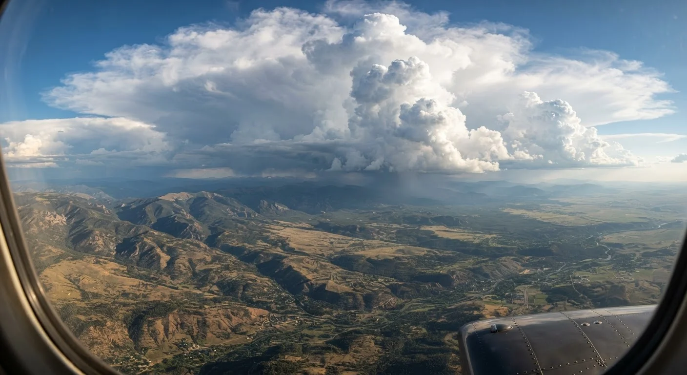
Photo: QuickAdvisor.net editorial
Key Takeaways
- Warm air is less dense than cool air, so it rises - a direct consequence of basic gas physics.
- The rising of warm air and sinking of cool air creates convection currents that drive much of Earth's weather.
- Convection explains everyday phenomena including sea breezes, thunderstorms, and uneven heating in your home.
- The same principle operates at vastly different scales, from your kitchen to planetary atmospheric circulation.
- Understanding convection helps make sense of how weather forecasts are built and why conditions change quickly.
The Simple Physics Behind Rising Air
Most of us learned as children that "heat rises." That phrase is a useful shortcut, but it obscures what's actually happening. Heat doesn't rise on its own - warm air rises, and it does so because of density, not some mysterious upward preference for warmth.
When you heat a parcel of air, the gas molecules inside it gain energy and move faster. Faster-moving molecules collide more forcefully and push each other farther apart, so the same mass of air now occupies more volume. More volume for the same mass means lower density. Place that less-dense air next to cooler, denser air at the same pressure level, and physics does the rest: the lighter parcel floats upward, exactly as a bubble of air rises through water.
The cooler, denser air around it flows inward and downward to fill the gap. That displacement creates a loop - warm air ascending, cool air descending - called a convection current. This loop is one of nature's most fundamental engines, operating at scales ranging from your coffee cup to the width of a continent.
~30,000 ft
Height a strong convective thunderstorm can reach
The National Weather Service notes that severe thunderstorm updrafts can push cloud tops to 30,000-60,000 feet - driven entirely by convective buoyancy forces.
10-15°F
Typical temperature difference between floor and ceiling
Building science research consistently finds that poorly circulated rooms stratify by roughly 10-15°F vertically in winter due to natural convection.
~3°F/1,000 ft
Dry adiabatic lapse rate as air rises
The American Meteorological Society defines the dry adiabatic lapse rate at approximately 3°F per 1,000 feet, describing how unsaturated rising air cools - a direct consequence of convective expansion.
Convection at Work: From Your Living Room to Storm Clouds
You encounter convection daily without naming it. Stand near a baseboard heater and you'll feel warm air drifting upward along the wall; press your hand to the ceiling above it and it's warmer than the floor below. The heater warms nearby air, that air rises, and cooler room air is drawn in at floor level to replace it. A slow, invisible wheel of air is turning in your living room at this very moment.
Scale that process up to a sunny summer afternoon, and convection becomes meteorology. The sun heats the ground unevenly - a dark asphalt parking lot absorbs more radiation than a neighboring grassy field. Air above the pavement heats faster, becomes less dense, and begins rising in a column called a thermal. Glider pilots and hawks both exploit thermals to gain altitude without expending energy.
When that rising air carries significant moisture, the results become visible. As the air climbs, it expands and cools. Cooler air holds less water vapor, so moisture condenses into the tiny water droplets that form clouds. A strong, sustained thermal can build a cloud vertically for miles, eventually producing the cumulonimbus towers responsible for afternoon thunderstorms - a dramatic example of convection made visible. For a deeper look at how the pressure changes within these systems affect you directly, see how air pressure shapes your world.
Sea Breezes and Global Circulation: The Same Loop, Bigger Stage
Coastal visitors often notice that a refreshing breeze blows in from the ocean during the day, then reverses direction after sunset. This classic sea breeze is textbook convection. Land heats and cools faster than water. By midday, the land surface is significantly warmer than the adjacent ocean, so air over the land rises. Cooler marine air flows inland at low altitude to replace it, delivering that welcome afternoon breeze. At night the land cools faster, the ocean is relatively warmer, and the circulation reverses.
The same logic applies at planetary scale. Intense solar heating near the equator drives massive columns of warm, moist air upward. That air spreads poleward at high altitude, gradually cools, and descends in the subtropics - creating the persistent high-pressure zones responsible for the world's great deserts. These large-scale convection loops, called Hadley cells, are a cornerstone of global climate patterns.
Understanding convection also sheds light on cooking. Whether you're roasting vegetables or simmering a stew, the movement of heated air or liquid around food is convection in action. How conduction, convection, and radiation work in the kitchen explains why these same principles determine how your oven temperature should be set and why a convection oven cooks faster.
Read the Sky for Convection Clues
Why This Matters for Reading the Weather
Convection is central to how meteorologists interpret and forecast conditions. When forecasters talk about atmospheric instability, they're describing how readily air parcels will rise once lifted - a direct measure of convection's potential strength. A highly unstable atmosphere, with sharp temperature differences between lower and upper levels, can transform a mundane warm afternoon into a severe-weather outbreak within hours.
Stable atmospheres, by contrast, resist vertical motion. Warm air aloft can act as a lid, suppressing rising surface air and keeping the sky clear - sometimes building heat at ground level until conditions become explosive. Understanding this suppression-and-release pattern is why tornado watches are issued hours before storms develop.
For everyday readers, recognizing convection as a concept transforms abstract weather reports into intuitive cause-and-effect. When a meteorologist says conditions are "convectively favorable," they mean the physical loop of rising warm air and sinking cool air is primed to intensify. The science behind your afternoon thunderstorm, your coastal breeze, and the warm air pooling at your ceiling is the same process - density seeking its level, relentlessly and elegantly, every second of every day.
Frequently Asked Questions
The content on this site is for informational purposes only and is not a substitute for professional advice. Always consult a qualified professional for guidance specific to your situation.